Outdoor and nature
Trails and outdoor routes
Explore the active routes on the portal with practical information, images and useful details to choose the right itinerary.
We are building an increasingly complete archive of local trails. Contributions from registered users help us improve information, photos, tips and reports.

Monte Gaggi - Pian Pontasco - SP 64 (REL trail marker / Alta Via connection)
A wild ridge itinerary crossing the high-altitude grasslands of Pian Pontasco and linking the summit of Monte Gaggi to provincial road SP 64.
e 3,4 km 1h 15m
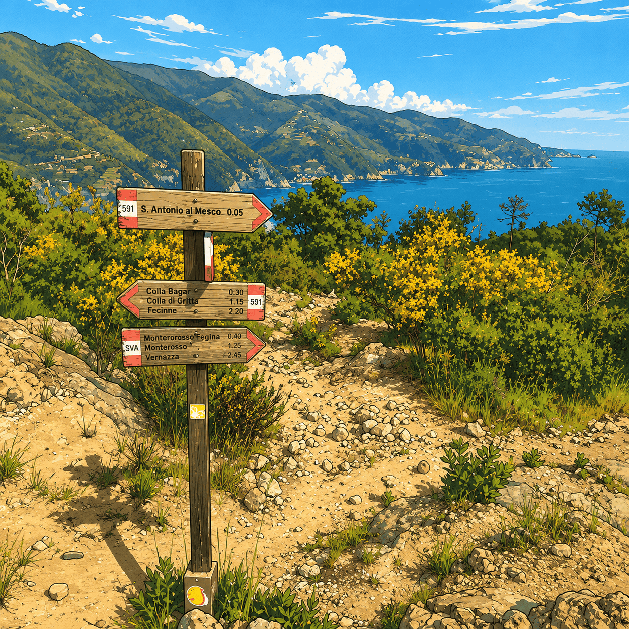
Vernazza - Madonna di Reggio - Foce di Drignana
A historic vertical mule track in the Cinque Terre linking Vernazza to the Sanctuary of Nostra Signora di Reggio and continuing to Foce di Drignana.
E 3,6 km 2h 15m
Pié di Fontona – Fontona – Colla di Gritta (REL trail marker 574 / former no. 4)
A fascinating steep ascent following the entire Fontona valley to the panoramic Colla di Gritta pass, gateway to the Cinque Terre.
E 3,8 km 1h 50m
Monte Rossola Ridge Trail (Rimessa - Rocca Galbana - Passo del Colletto)
One of the most spectacular and airy ridge traverses in eastern Liguria, suspended between the Bonassola coastline and the inland reliefs of the Bracco area.
E 4,1 km 2h
Framura (Setta) - Ressa - Foce del Prato - Monte Serra - Case Serra (REL route GSPA65162VE)
Un affascinante itinerario verticale e di mezza costa che connette le storiche frazioni interne di Framura con la cresta panoramica del Monte Serra (Monte Serro), inoltr…
E 4,2 km 1h 50m
Mulino Bellolio - Laghello - Marselesso - Foce di Vaggi (REL trail marker)
A fascinating itinerary in the Ligurian hinterland climbing along old waterways and through hillside villages to the panoramic Foce di Vaggi pass.
E 4,2 km 1h 50m
San Gottardo – Le Ghiare – Lerici – AV5T junction (REL trail marker)
A strategic connecting itinerary linking the San Gottardo pass to the upper variants of the Alta Via, passing through historic rural settlements.
E 4,3 km 1h 55m
Case Cadato - Monte Pelizza - Monte Castagnola - Colle Forcola - AV5T junction
Uno straordinario e selvaggio itinerario multi-vetta di crinale nell'entroterra di Framura e Deiva Marina, che unisce panorami appenninici a scorci mozzafiato sul Mar Li…
E 4,5 km 1h 30m
Pian delle Rose - Moggia - Pian della Madonna - Baracca (REL trail marker)
A woodland ridge and mid-slope traverse linking evocative mountain plateaus and historic rural settlements in the Levanto hinterland.
E 4,8 km 1h 55m
Vandarecca - Montaretto - Reggimonti – AV5T junction
A splendid panoramic hillside itinerary between the historic villages of Montaretto and Reggimonti, reaching the junction with the Alta Via delle Cinque Terre.
E 4,8 km 1h 50m
Framura (Setta) - Costa - Castagnola - Monte Sant'Agata (REL trail 650)
Una splendida e costante ascesa verticale che attraversa gli storici borghi in pietra e i terrazzamenti di Framura, per poi addentrarsi nei boschi fino ai ruderi medieva…
E 6,2 km 2h 50m
Reggimonti - Monte Gaggi - SP 64 - Monte Grumo (REL trail marker / Bracco Ridge)
A spectacular and wild ridge traverse linking the historic hillside village of Reggimonti to the panoramic and geological summits of the Bracco area.
E 6,2 km 2h 30m